
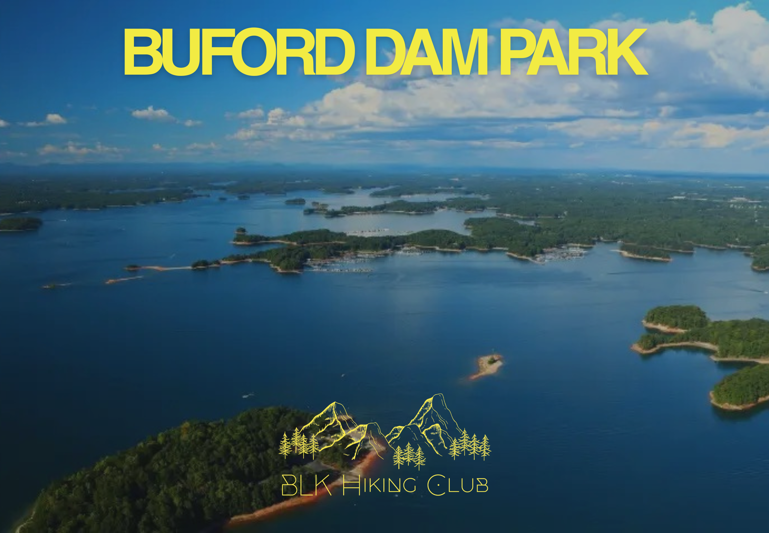
Buford Dam Park (GA)
Registration Opens Thursday, April 2nd at 7pm
We’ll be hitting the trails at Buford Dam Park, winding through the woods with stunning views of Lake Lanier and the Chattahoochee River. This is more than just a hike. It’s a celebration of every trail we’ve conquered together.
Important Registration Info - Please Read
If Registration Appears "Closed": This means we have hit capacity. Please do not panic! Life happens, and people often cancel leading up to the hike.
How To Get A Spot: If a spot opens up, registration will automatically re-open. We recommend checking back frequently.
Length: 3.6mi | Elevation Gain: 449ft | Trail Type: Loop | Distance From Atlanta: 50 min
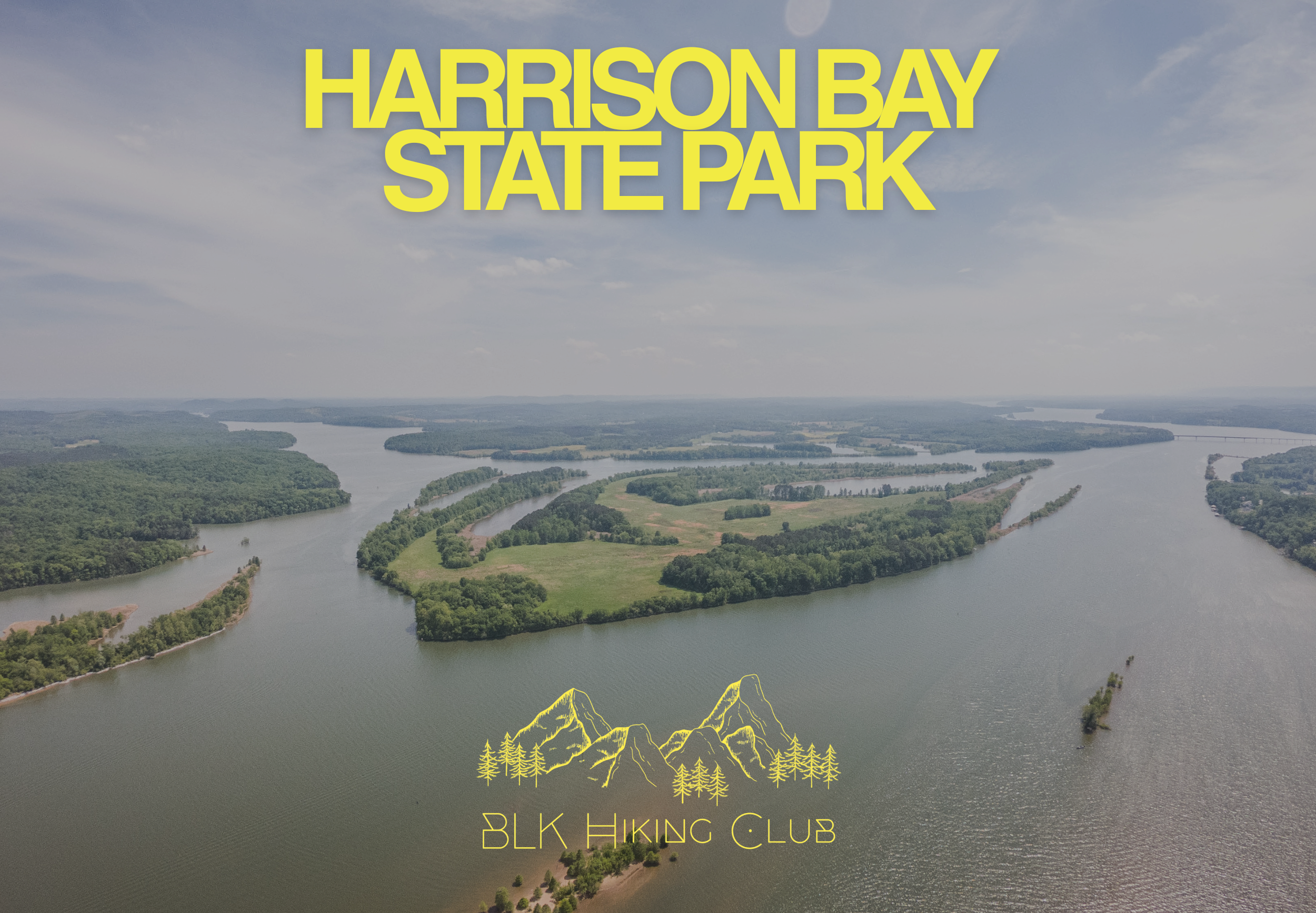
Harrison Bay State Park (TN)
Registration Opens Thursday, April 16th at 7pm
Join us as we head to Harrison Bay State Park to explore the beautiful shoreline of Chickamauga Lake. This hike is all about taking in the water views and enjoying the shade of the towering pines. It’s a relatively flat and friendly trail.
Important Registration Info - Please Read
If Registration Appears "Closed": This means we have hit capacity. Please do not panic! Life happens, and people often cancel leading up to the hike.
How To Get A Spot: If a spot opens up, registration will automatically re-open. We recommend checking back frequently.
Length: 4.2mi | Elevation Gain: 111ft | Trail Type: Loop | Distance From Atlanta: 1 hr 50 min
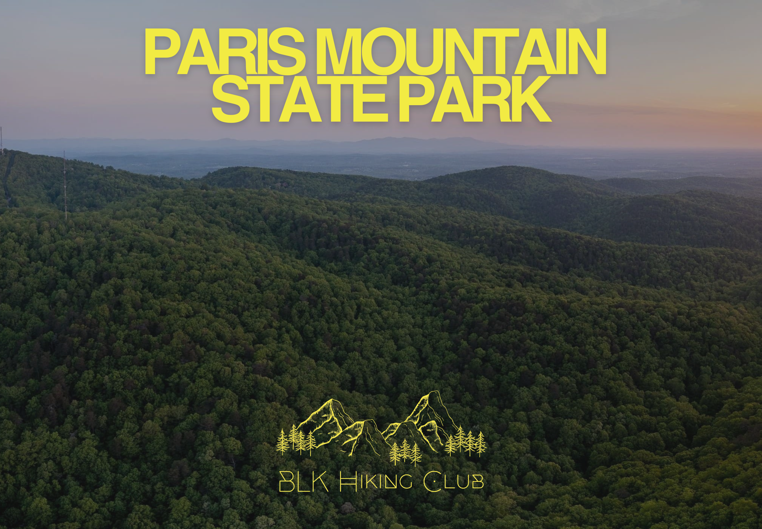
Paris Mountain State Park (SC)
Registration Opens Thursday, April 30th at 7pm
Ready to elevate your hiking game? We’re heading to the iconic Paris Mountain State Park for a trek that’s as challenging as it is beautiful. After our relaxing lakeside strolls, it’s time to get the heart rate up and hit the switchbacks!
Important Registration Info - Please Read
If Registration Appears "Closed": This means we have hit capacity. Please do not panic! Life happens, and people often cancel leading up to the hike.
How To Get A Spot: If a spot opens up, registration will automatically re-open. We recommend checking back frequently.
Length: 5.3mi | Elevation Gain: 744ft | Trail Type: Loop | Distance From Atlanta: 2 hr 20 min
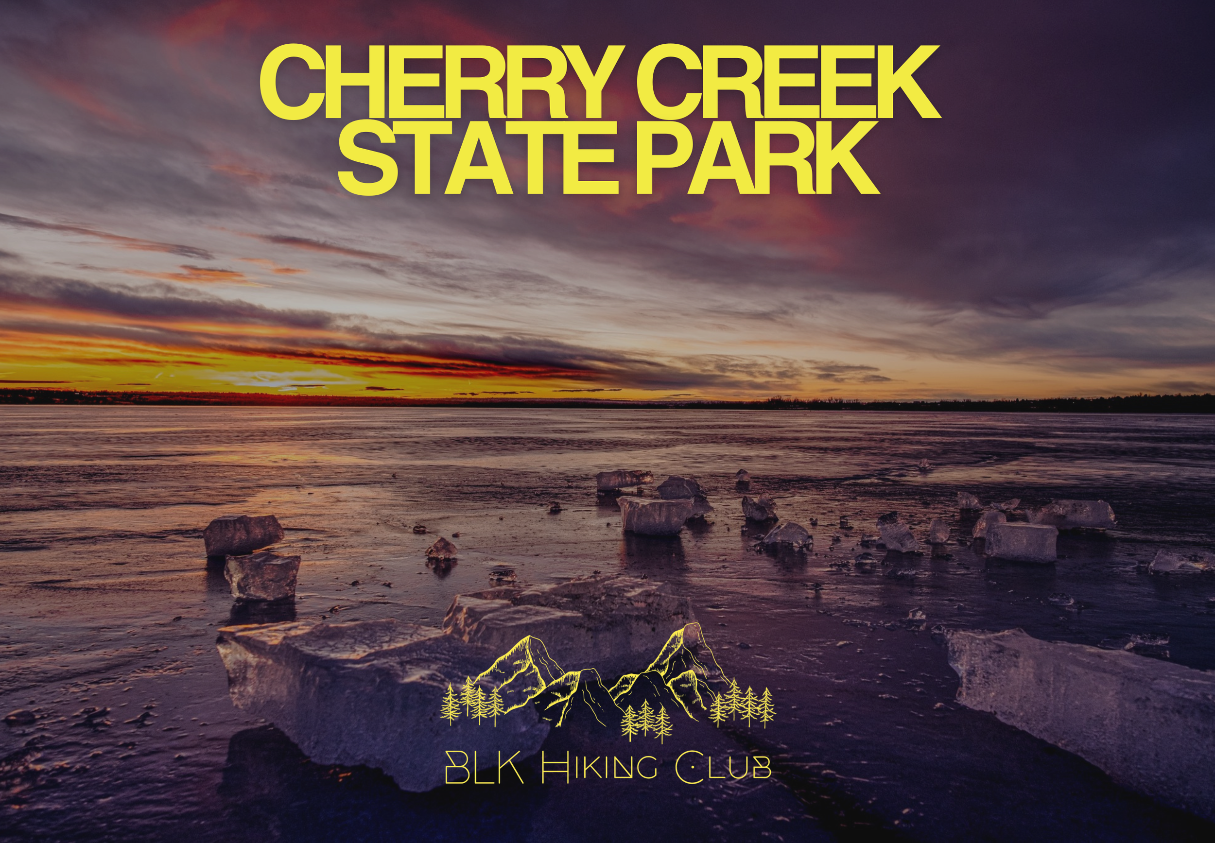
Cherry Creek State Park (CO)
We have some massive news to share! BLK Hiking Club has been officially invited to host the Sunrise Hike at Hike Expo Colorado! We are so honored to bring our energy to the Rockies. Whether you’re traveling with us to Denver or you’re a Colorado local joining our crew for the first time, come see why we were tapped to lead the way as the sun rises over the Front Range.
Length: 6.5mi | Elevation Gain: 134ft | Trail Type: Loop
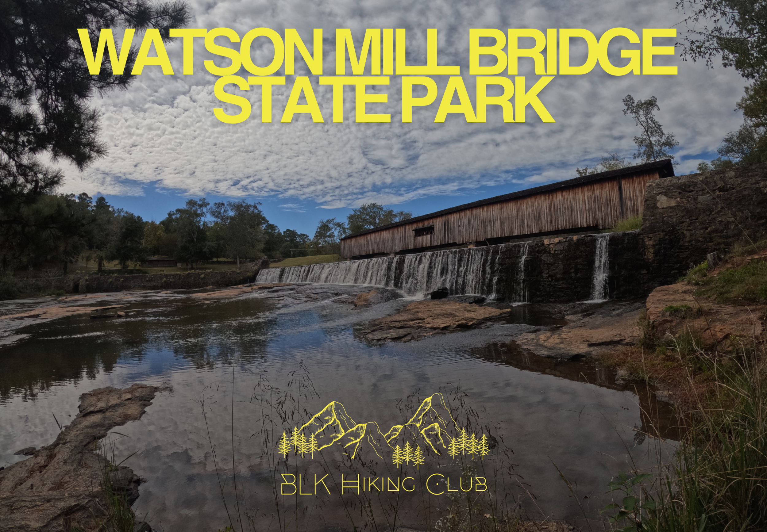
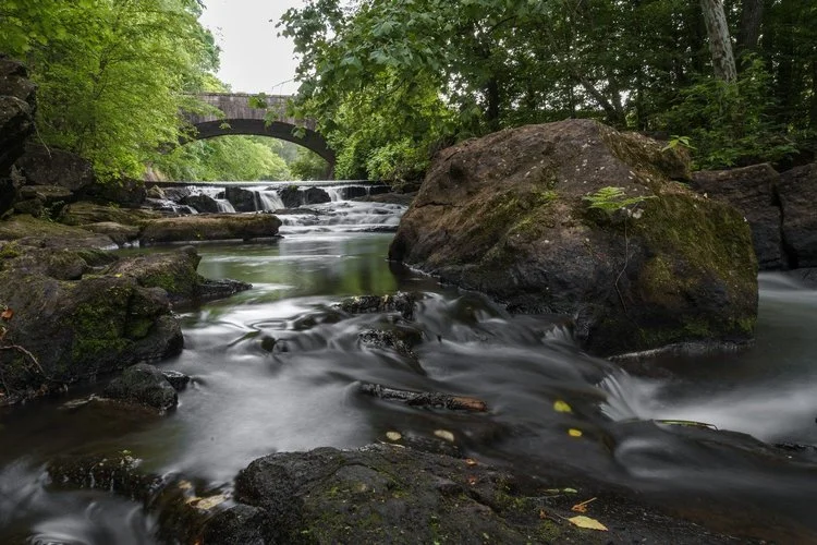
Watson Mill Bridge State Park (GA)
Registration Opens Thursday, June 4th at 7pm
Join us at Watson Mill Bridge State Park, home to the longest original covered bridge in Georgia. This trip features a guided hike through the towering hardwoods and across the massive 229-foot historic covered bridge. But the real highlight? The sliding rocks! We’ll be stopping by the rushing shoals where the water cascades over smooth granite, creating nature's own water park.
Important Registration Info - Please Read
If Registration Appears "Closed": This means we have hit capacity. Please do not panic! Life happens, and people often cancel leading up to the hike.
How To Get A Spot: If a spot opens up, registration will automatically re-open. We recommend checking back frequently.
Length: 4.6mi | Elevation Gain: 340ft | Trail Type: Loop | Distance From Atlanta: 1 hr 30 min
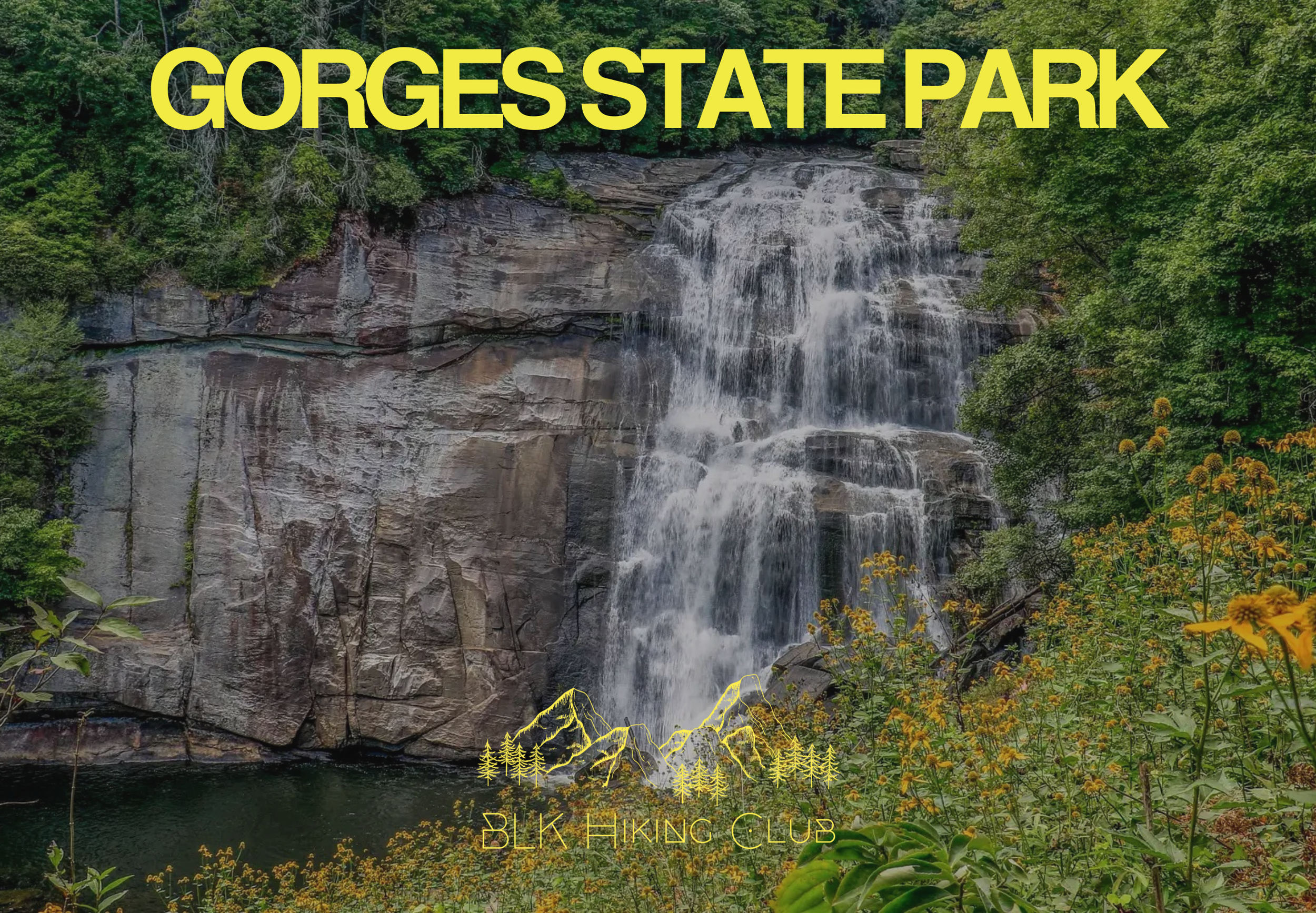
Gorges State Park (NC)
Registration Opens Thursday, June 18th at 7pm
We’re heading into the rugged heart of Gorges State Park, a place where the mountains literally meet the falls. This isn't your average woodland stroll. We’ll be navigating the lush, rainforest-like terrain to witness the power of the Horsepasture River. From the thundering mist of Rainbow Falls to the hidden gems tucked along the trail, this hike is all about the "wow" factor.
Important Registration Info - Please Read
If Registration Appears "Closed": This means we have hit capacity. Please do not panic! Life happens, and people often cancel leading up to the hike.
How To Get A Spot: If a spot opens up, registration will automatically re-open. We recommend checking back frequently.
Length: 4mi | Elevation Gain: 770ft | Trail Type: Out & Back | Distance From Atlanta: 2 hr 20 min

Table Rock State Park
Difficulty Warning: Intermediate & Experienced Hikers Only
Limited Spots: Due to the distance and limited parking the cap for this hike is 100.
🚨 Important Registration Info - Please Read
If Registration Appears "Closed": This means we have hit capacity. Please do not panic! Life happens, and people often cancel leading up to the hike.
How To Get A Spot: If a spot opens up, registration will automatically re-open. We recommend checking back frequently.
Length: 6.8mi | Elevation Gain: 2,316ft | Trail Type: Out & Back | Distance From Atlanta: 2 hr 25 min

State Botanical Garden of Georgia
Length: 3.9mi | Elevation Gain: 387ft | Trail Type: Loop | Distance From Atlanta: 1 hr 10 min
Important Registration Info - Please Read
If Registration Appears "Closed": This means we have hit capacity. Please do not panic! Life happens, and people often cancel leading up to the hike.
How To Get A Spot: If a spot opens up, registration will automatically re-open. We recommend checking back frequently.
Bringing a Guest (+1)? If you secured a spot and want to bring a guest, please do not try to register them here if the event is full. Look for the Google Form link in the group chat to register your plus-one properly.
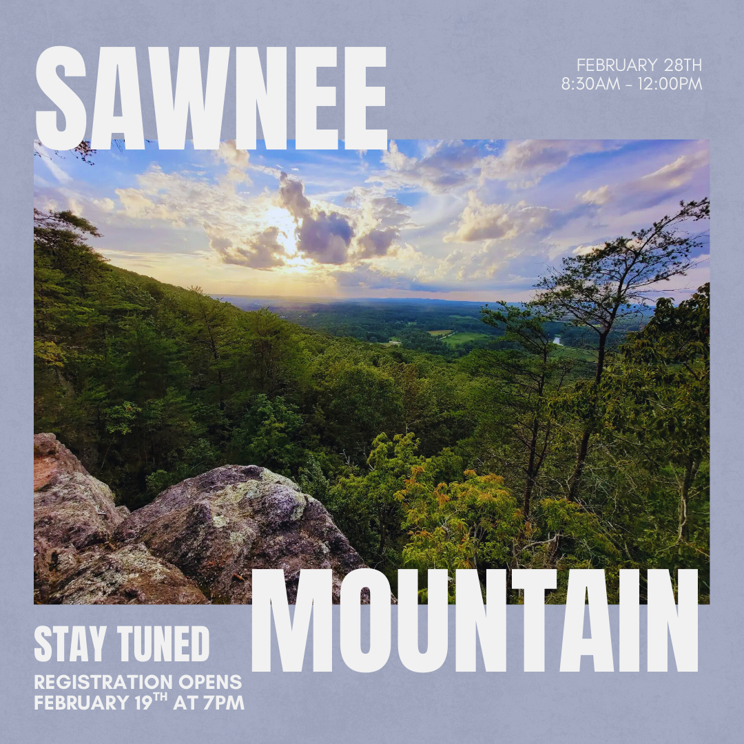
Sawnee Mountain
Length: 3.5mi | Elevation Gain: 508ft | Trail Type: Loop | Distance From Atlanta: 50 min
Important Registration Info - Please Read
If Registration Appears "Closed": This means we have hit capacity. Please do not panic! Life happens, and people often cancel leading up to the hike.
How To Get A Spot: If a spot opens up, registration will automatically re-open. We recommend checking back frequently.
Bringing a Guest (+1)? If you secured a spot and want to bring a guest, please do not try to register them here if the event is full. Look for the Google Form link in the group chat to register your plus-one properly.
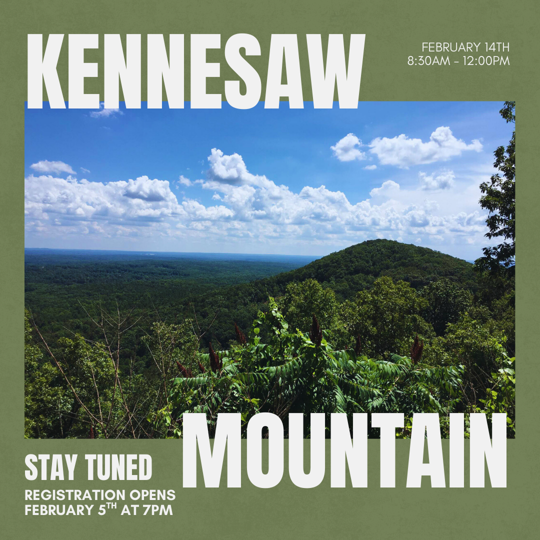
Kennesaw Mountain
Length: 3.4mi | Elevation Gain: 682ft | Trail Type: Loop | Distance From Atlanta: 30 min
Important Registration Info - Please Read
If Registration Appears "Closed": This means we have hit capacity. Please do not panic! Life happens, and people often cancel leading up to the hike.
How To Get A Spot: If a spot opens up, registration will automatically re-open. We recommend checking back frequently.
Bringing a Guest (+1)? If you secured a spot and want to bring a guest, please do not try to register them here if the event is full. Look for the Google Form link in the group chat to register your plus-one properly.
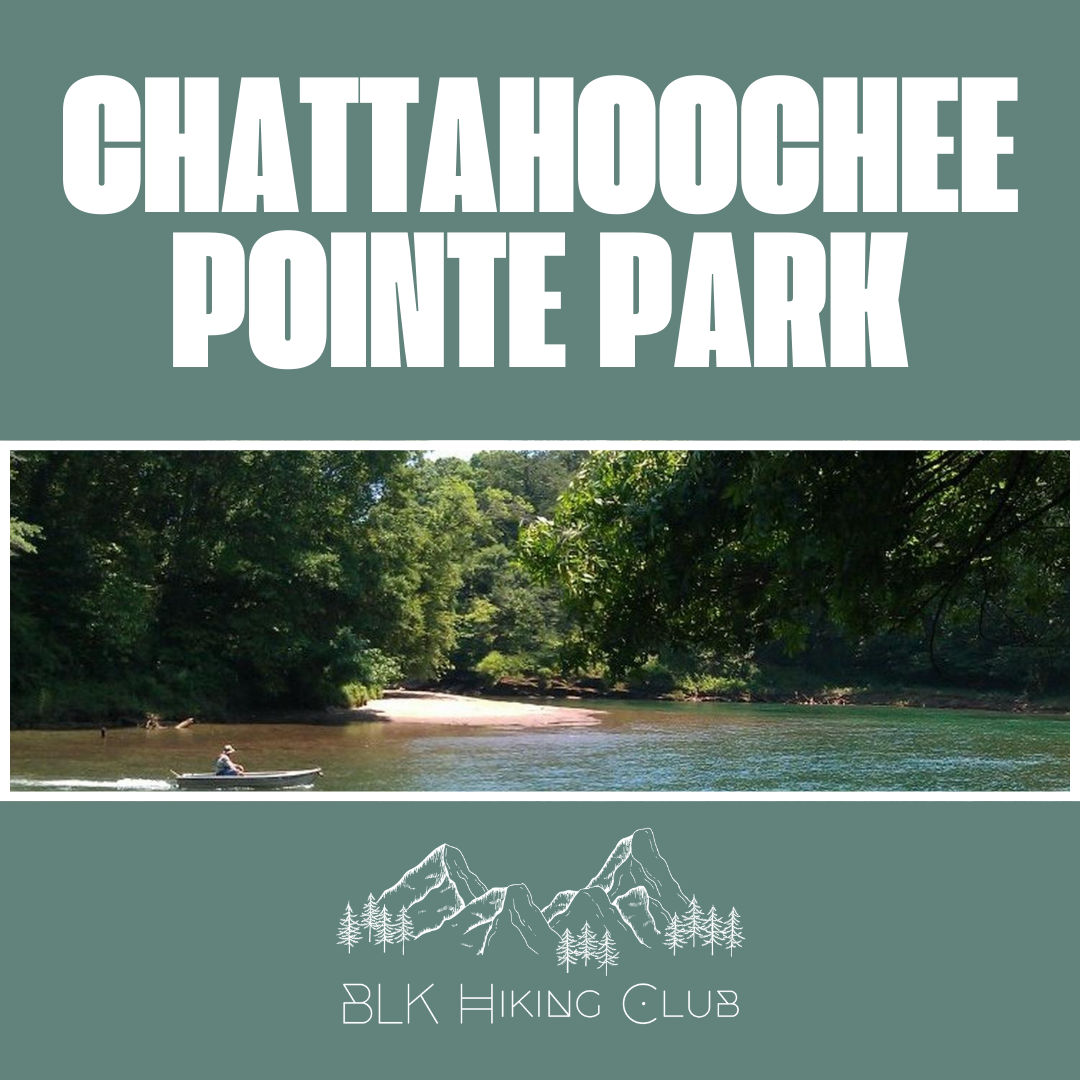
Chattahoochee Pointe Park
Length: 3.1mi | Elevation Gain: 36ft | Trail Type: Loop | Distance From Atlanta: 45 min | Difficulty: Easy
Important Registration Info - Please Read
Because our kickoff event was packed, we expect spots for this one to go just as fast.
If Registration Appears "Closed": This means we have hit capacity. Please do not panic! Life happens, and people often cancel leading up to the hike.
How To Get A Spot: If a spot opens up, registration will automatically re-open. We recommend checking back frequently.
Bringing a Guest (+1)? If you secured a spot and want to bring a guest, please do not try to register them here if the event is full. Look for the Google Form link in the group chat to register your plus-one properly.

Fort Yargo State Park
Length: 6mi | Elevation Gain: 360ft | Trail Type: Loop | Distance From Atlanta: 1 hr | Difficulty: Moderate
We are kicking off the new year the best way we know how: with fresh air and lake views. Join us at Fort Yargo State Park for our first official group hike of the season. Let’s set the tone for a year full of adventure!
Important Registration Info - Please Read
Because this is our first event of the year, we expect spots to fill up immediately.
If Registration Appears "Closed": This means we have hit capacity. Please do not panic! Life happens, and people often cancel leading up to the hike.
How To Get A Spot: If a spot opens up, registration will automatically re-open. We recommend checking back frequently.
Bringing a Guest (+1)? If you secured a spot and want to bring a guest, please do not try to register them here if the event is full. Look for the Google Form link in the group chat to register your plus-one properly.
Let's make this a great start to 2026. See you on the trail!

The S.O.U.L Hike: Tribble Mill Park
We’re closing out the season with something special! An exclusive hike and mindfulness experience led by Ace Hood in collaboration with his S.O.U.L Fitness Series, uniting movement, music, and mindfulness!
What You Can Expect:
Warm up to Ace’s latest project S.O.U.L
Guided Hike + Mindfulness Conversation with Ace Hood
Hydration Recovery Station powered by Union Fit Hub
Length: 4.1mi | Elevation Gain: 282ft | Trail Type: Loop | Distance From Atlanta: 50 min
AllTrails Map: Tribble Mill Park Loop
Chasing Fall Colors Hike: Tallulah Gorge State Park
Join us for a beautiful farewell to the season as we chase the brilliant fall colors through one of the most breathtaking canyons in the Southeast: Tallulah Gorge State Park. Whether you’re exploring rim overlooks or hiking down into the gorge, it’s a stunning spot to experience nature’s power and beauty from the dramatic cliffs, cascading waterfalls, and miles of scenic trails.
As a special thank you to our sponsors Timeout & Trojan Brands Condoms for making this hike even more special. We’ll have giveaways and other surprises waiting for you.
Length: 2.5mi | Elevation Gain: 708ft | Trail Type: Loop | Distance From Atlanta: 1 hr 30 min
AllTrails Map: Tallulah Gorge Overlooks Trail
Pink & Purple Hike: Harrison Bay State Park
Harrison Bay State Park in Tennessee is a beautiful lakeside escape with peaceful hiking trails, abundant wildlife, and stunning waterfront views. Perfect for hiking, picnicking, or just relaxing in nature, it’s a great spot to slow down and enjoy the outdoors.
Length: 4.2mi | Elevation Gain: 118ft | Trail Type: Loop | Distance From Atlanta: 1 hr 54 min
AllTrails Map: Bay Point Loop Trail
Rep Your Team Hike: Hard Labor Creek State Park
Hard Labor Creek State Park in Georgia is a peaceful getaway with beautiful hiking trails, quiet lakes, and rolling woodlands. Known for its natural beauty and relaxing atmosphere, it’s a perfect spot for outdoor adventures and picnics.
Length: 2.3mi | Elevation Gain: 164ft | Trail Type: Loop | Distance From Atlanta: 50 min
AllTrails Map: Hard Labor Creek Beach Loop

Self-Care Awareness Month Hike: High Falls State Park
High Falls State Park in Georgia is a scenic escape known for its stunning cascades along the Towaliga River. With beautiful hiking trails, serene picnic spots, and peaceful forest views, it’s the perfect place to slow down, recharge, and connect with nature.
Length: 3.8mi | Elevation Gain: 370ft | Trail Type: Loop | Distance From Atlanta: 45 min
AllTrails Map: Historic and Tranquil Trails Loop

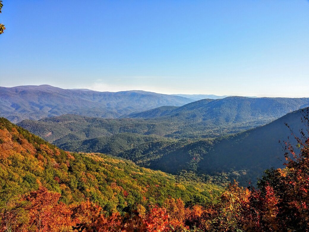
Sunset Hike: Brasstown Bald
Located within the Chattahoochee-Oconee National Forests, the Brasstown Bald Recreation Area & Visitor Center is the highest point in Georgia, rising 4,784 feet above sea level. On the Bald you’ll find picnic areas with great views; a general store with locally made products; three trailheads just off of our parking lot; a mountaintop natural science & history museum, and observation deck that offers a spectacular 360° view of the surrounding area, including four states (GA, TN, NC, & SC) and on a really clear day, even the skyline of Atlanta!
Length: 1.3mi | Elevation Gain: 426ft | Trail Type: Out & Back | Distance From Atlanta: 2 hr
AllTrails Map: Brasstown Bald Trail

Bring Your Kids To Hike Day: Little Mulberry Park
Join us for Bring Your Kids To Hike Day, featuring a fun superhero theme! The Miller Lake Trail is one of many trails in the Little Mulberry Park trail system which walkers, bicyclists, and hikers enjoy on a daily basis. The loop trail circles Miller Lake and abuts open pastures and mature hardwood forests providing opportunities for viewing birds and a variety of wildlife species in their natural habitats.
Length: 2.4mi | Elevation Gain: 134ft | Trail Type: Loop | Distance From Atlanta: 42 min
AllTrails Map: Miller Lake Trail

Challenge Yourself Month Hike: Mount Yonah
One of north Georgia's most popular hikes for good reason, Mount Yonah offers breathtaking views from the south to the northwest all along its lengthy bare rock face. The scenery is even more rewarding due to the steep climb of 1400 feet in just over 2 miles. Although this trail is definitely not for beginners, it's one that should be on every hiker's bucket list.
Length: 4.3mi | Elevation Gain: 1,489ft | Trail Type: Out & Back | Distance From Atlanta: 1 hr 28 min
AllTrails Map: Mount Yonah Trail

Challenge Yourself Month Hike: Gorges State Park
Gorges State Park is the access point to hike to one of our favorite waterfalls, Rainbow Falls, and nearby Turtleback Falls. It's home to rugged river gorges, sheer rock walls and one of the greatest concentrations of rare and unique species in the eastern United States. This relatively new North Carolina state park opened in 2009 with paved roads, parking areas, trails, primitive campsites and two picnic shelters. Most of the park is remote with little access to protect its many ecosystems.
Length: 3.9mi | Elevation Gain: 770ft | Trail Type: Out & Back | Distance From Atlanta: 2 hr 25 min
AllTrails Map: Rainbow Falls, Turtleback Falls, and Drift Falls
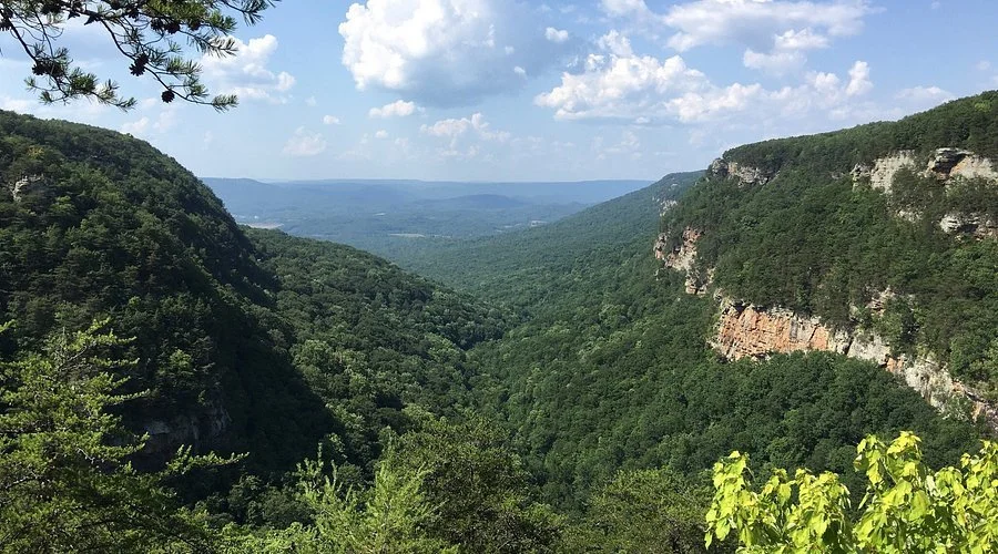
Men’s Health Month Hike: Cloudland Canyon State Park
Join us for our Men’s Health Month Hike — open to everyone!
In honor of Men’s Health Month, we’re hitting the trails at Cloudland Canyon State Park to encourage movement, wellness, and community connection.Everyone is welcome to sign up, show support, and enjoy the outdoors together.
Located on the western edge of Lookout Mountain, Cloudland Canyon State Park is one of Georgia’s most scenic parks, offering rugged geology and beautiful vistas. The park straddles a deep gorge carved by Sitton's Gulch Creek, and features thousand-foot deep canyons, sandstone cliffs, waterfalls, cascading creeks, wild caves, and abundant wildlife — making it the perfect place to reflect, recharge, and reconnect.
Length: 4.9mi | Elevation Gain: 1,020ft | Trail Type: Out & Back | Distance From Atlanta: 2 hr
AllTrails Map: Sitton’s Gulch Trail

Juneteenth Celebration Hike: Lower and Upper Whitewater Falls
Whitewater Falls is the highest waterfall east of the Rockies, falling 811 feet! Many times you'll see a rainbow in front of the waterfall caused by the mist and the just-right sun angle. The Upper Falls plummets 411 feet, and is 60 miles from downtown Asheville in the Nantahala National Forest. It's on the Whitewater River in the Jocassee Gorge area of North Carolina.
Length: 5.6mi | Elevation Gain: 990ft | Trail Type: Out & Back | Distance From Atlanta: 2 hr 18 min
AllTrails Map: Lower and Upper Whitewater Falls
Summer Kickoff Hike: Amicalola Falls State Park
Amicalola Falls State Park features the tallest cascading waterfall in the southeast. The falls stack up at 729 feet and got their name from the Cherokee for “tumbling waters.” Amicalola Falls State Park is also connected to the southern end of the Appalachian Trail via a 10 mile trail to Springer Mountain. If you decided to start hiking the trail from there it would take you 2,190 miles through 14 states to get from Georgia to Maine.
Length: 2.4mi | Elevation Gain: 813ft | Trail Type: Loop | Distance From Atlanta: 1 hr 19 min
AllTrails Map: Amicalola Falls Loop

Mental Health Hike: Lullwater Preserve
Prepare for a fun adventure as we take on Lullwater Preserve in Atlanta, GA! This 3.2-mile loop trail features a 157-foot elevation gain and is rated easy. It offers scenic trails, skirts Candler Lake and crosses a span bridge to explore a mill beside a tumbling spillway waterfall in a beautiful, wildlife-rich forest.
AllTrails Map: Lullwater Loop

Cheers To 75 Hike: Sandy Creek Park
We’re hitting a huge milestone—our 75th hike as a club! Join us as we celebrate this achievement with an unforgettable adventure at Sandy Creek Park in Athens, GA. This 7.3-mile loop with 374 feet of elevation gain offers a mix of challenging terrain, scenic lake views, and rewarding moments on the trail. Rated moderate to hard, this hike is perfect for those ready to push themselves while embracing the beauty of nature. Located just 1 hour and 15 minutes from Atlanta, it’s the ideal setting to commemorate how far we’ve come as a community!
AllTrails Map: Sandy Creek Lakeside Trail

Furry Friends Hike Day: Cauley Creek Park
Grab your leash and lace up your hiking boots—it’s time for Furry Friends Hike Day sponsored by The Farmer’s Dog! This easy 3.2-mile loop with just 49 feet of elevation gain is the perfect trail for you and your fur baby to enjoy together. Located only 35 minutes from Atlanta, Cauley Creek Park offers open green spaces and scenic paths, making it ideal for a relaxing adventure with your pup.
AllTrails Map: Cauley Creek Park Trail

Women’s History Month Hike: Tugaloo State Park
Join us for another exciting adventure as we explore the scenic trails of Tugaloo State Park! This 3.6-mile loop, with 364 feet of elevation gain, offers a peaceful journey through lush forests and beautiful lake views. Rated easy to moderate, it is perfect for hikers of all levels looking to enjoy nature and connect with the community. Located just one hour and thirty minutes from Atlanta, it’s the ideal escape for a day of fresh air and movement.
AllTrails Map: Sassafras Loop

Spring Kickoff Hike: Bowmans Island Trail
Join us as we officially kick off the spring hiking season with a scenic adventure at Bowman's Island in Buford, GA! This moderate 3.9-mile out-and-back trail features 170 feet of elevation gain, offering the perfect mix of challenge and beauty. Just 50 minutes from Atlanta, it provides stunning river views, peaceful forest paths, and a refreshing outdoor experience to start the season strong.
AllTrails Map: Bowman’s Island Trail

Booker T. Washington State Park
Celebrate Black History Month with us as we embark on a meaningful hiking adventure at Booker T. Washington State Park. The Honoring Black Excellence Hike will take us along a 7.4-mile loop trail, offering a moderate challenge with an elevation gain of 524 feet. This scenic route provides the perfect opportunity to reflect, connect with nature, and celebrate the legacy of Black excellence.
Just 1 hour and 46 minutes from Atlanta, Booker T. Washington State Park is an inspiring backdrop for this special hike. We encourage participants to wear shirts that honor Black culture, icons, and history as we walk in the footsteps of those who paved the way for us.
Join us for a day of exploration, reflection, and community. We can’t wait to hike with you!
AllTrails Map: Booker T. Washington Trail

Sawnee Mountain Preserve
Kick off the new year on the right foot and experience the natural beauty of Sawnee Mountain Preserve as we embark on a hiking adventure along the Indian Seats Loop Trail. This 3.6-mile loop offers a moderate challenge with an elevation gain of 515 feet, making it perfect for novice and seasoned hikers. We'll explore diverse landscapes, enjoy stunning views, and connect with nature along the way.
Sawnee Mountain Preserve is a 47-minute drive from Atlanta. This makes it an ideal destination for a quick getaway to nature without spending too much time on the road.
Join us for a day of adventure and outdoor fun. We look forward to hiking with you!
AllTrails Map: Indian Seats Loop

Ivy Creek Greenway
The greenway’s wide, gently meandering path varies in elevation as it curves through wildlife and waterfowl-filled wetlands over boardwalks and paved trails.
Length: 4.5 Miles | Elevation Gain: 413 FT | Trail Type: Out & Back | Difficulty: Easy to Moderate
Fort Mountain State Park
This hike packs in a ton of interest and natural beauty on its relatively short, beginner-friendly distance, and visits of the best views in all of Georgia’s State Parks.
Length: 5.8 Miles | Elevation Gain: 1,420 FT | Trail Type: Loop | Difficulty: Hard

BLK Women’s Hike: Kennesaw Mountain
This BLK Women’s Hike will focus on engaging in conversations about some of Black women's experiences while honoring Breast Cancer Awareness Month 🩷 and National Domestic Violence Awareness Month 💜.
Length: 3.8 Miles | Elevation Gain: 702 FT | Trail Type: Loop | Difficulty: Moderate to Hard

Cloudland Canyon State Park
Cloudland Canyon is easily one of the most scenic of Georgia’s State Parks. Stunning waterfalls, incredible long-range views, sheer canyon walls, and spectacular sunsets make the park one of our favorite hiking and camping destinations in our state.
Length: 5 Miles | Elevation Gain: 744 FT | Trail Type: Loop | Difficulty: Moderate to Hard

Red Top Mountain State Park
Sprawling several thousand acres, the park is home to a handful of fantastic hiking and running trails that wind and meander over its gently rolling forests and beside Allatoona’s iron-rich shores.
Length: 5.3 Miles | Elevation Gain: 518 FT | Trail Type: Loop | Difficulty: Moderate to Hard